Feature Wiki
Tabs
OpenLayers Maps
1 Requirements
Currently ILIAS uses GoogleMaps to provide maps and geolocation services. Similar functionality could be provided by using OpenLayers in conjunction with OpenStreetMaps. Since the license of the GoogleMaps-API only permits free use for free and publicly available services, many ILIAS installations might be breaking that license. On the contrary, OpenLayers and OpenStreetMaps could be used without costs for licensing. Moreover, using OpenData fits OpenSource much better then relying on services provided by a company like Google. The idea therefore is to either replace GoogleMaps completely with an OpenLayers/OpenStreetMaps solution or to let administrators decide which type of map should be used within their ILIAS installation.
2 Status
- Scheduled for: ILIAS 5.0
- Funding: Funded by CaT Concepts and Training GmbH (Concepts and Training)
- Development: Feature is developed by CaT Concepts and Training GmbH
- Maintainer: Richard Klees
3 Additional Information
- If you want to know more about this feature, its implementation or funding, please contact: Richard Klees richard.klees@concepts-and-training.de
- We already have a running version based on ILIAS 4.2
4 Discussion
- Could we easily migrate all features that currently use google maps to OpenLayers? E.g. the groups/course members map feature?
- Would you be willing to take over maintainership for this component (see DevGuide)?
- at 1: I don't see any problems. Grep for "GoogleMaps" gave me 7 locations where the GoogleMaps Service is used. In our local installation, i already changed 5 of those files, without any problems. Both APIs support the same basic features (except for the "type" of the map, satellite/streets) used in ILIAS, so i just reimplemented the GoogleMaps-Service in terms of OpenLayers and used it as a drop in replacement.
- at 2: Yes, i would.
AK 12 June 2013: Great, in this case I fully support this move. I also think that we should get rid of "commercial" third party dependencies as soon as possible. We will discuss this on the Jour Fixe.
JF 20 Jan 2014: We highly appreciate this feature and schedule it for 4.5. Open street map should be available as an option (globally) beside GoogleMaps.
JE 22 Sep 2014: Seems to be implemented. Could be moved to to category C on ILIAS 5.0.
5 Implementation
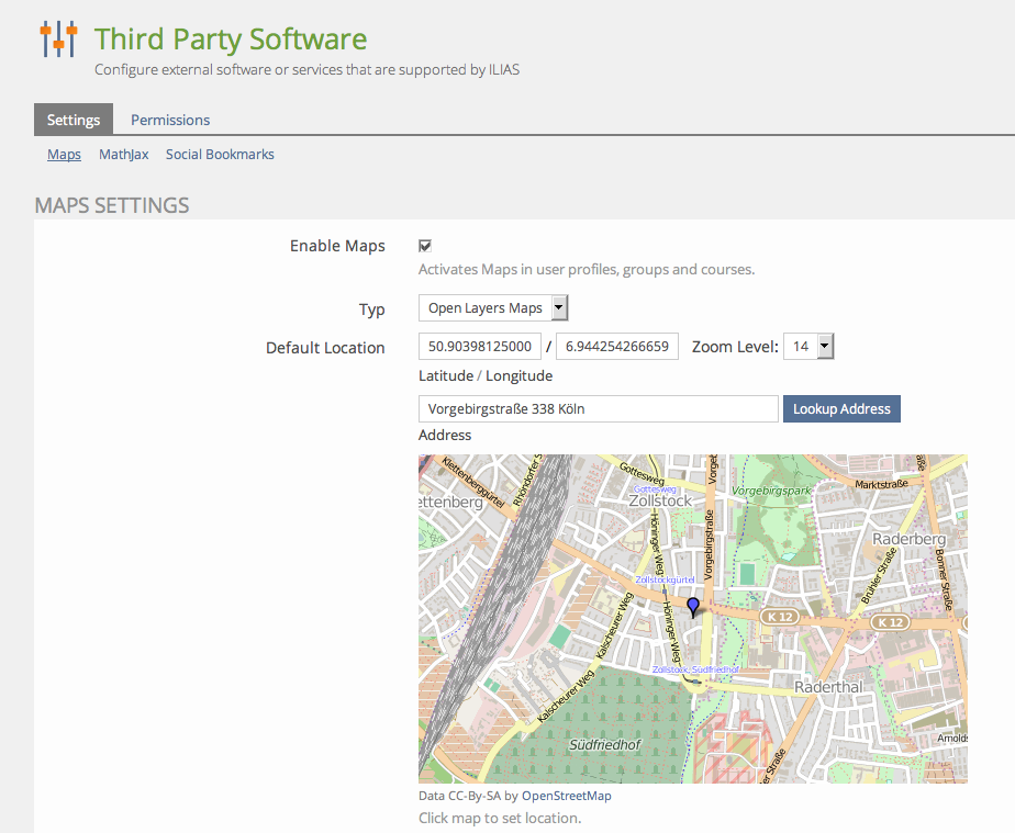
Administrators could choose the implementation to use for the maps service at Administration > Third Party Software > Maps from Open Layers Maps and Google Maps. The maps defaults to Open Layers when activated.

Last edited: 17. Apr 2025, 14:48, Kunkel, Matthias [mkunkel]